
- News
- UK
- Home News
The fallout of the storm led to disruption across the UK on Friday
Dan Haygarth Saturday 10 January 2026 00:04 GMT- Bookmark
- CommentsGo to comments
Bookmark popover
Removed from bookmarks
Close popover CloseSimon Calder documents chaos across train travel in Midlands as Storm Goretti brings heavy snowfall
Get the free Morning Headlines email for news from our reporters across the world
Sign up to our free Morning Headlines email
Sign up to our free Morning Headlines email
Email*SIGN UPI would like to be emailed about offers, events and updates from The Independent. Read our Privacy notice
Hurricane-force winds and heavy snow battered the UK as Storm Goretti caused chaos around Britain, leading to flight cancellations, school closures and power outages.
The storm arrived in the UK on Thursday, generating a rare red “danger to life” weather warning from the Met Office, with winds of around 100mph hitting the South West and snow blanketing Scotland, the Midlands and Wales.
A peak gust of 99mph was reported at St Marys on the Isles of Scilly, the highest since 1991, according to the Met Office, while a weather station in Cornwall reported hurricane-force gales of 123mph at 7.30pm on Thursday.
Nearly 150,000 households were also without power following outages in the South West, Midlands, and south Wales.
Approximately 37,000 properties were still without power in the South West at about 8pm on Friday, according to the National Grid, along with about 3,000 in the West Midlands, more than 1,000 in the East Midlands, and about 240 in Wales.
Cornwall Council leader Leigh Frost said the storm had caused “major disruption across parts of Cornwall, particularly to roads, coastal areas and local infrastructure”.
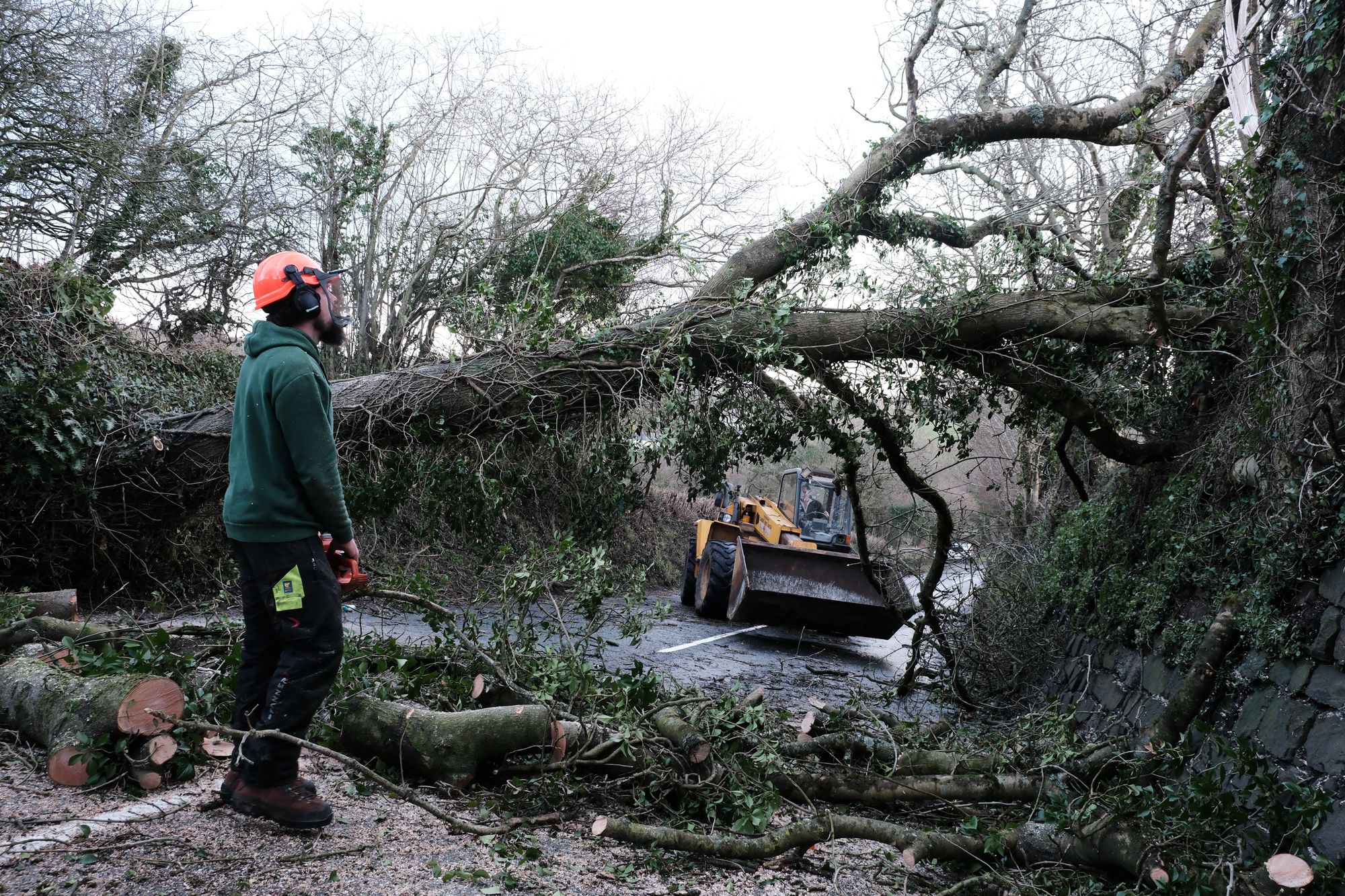 open image in galleryA fallen tree is cleared from a road in St Stephen, Cornwall (PA)
The roof of the grandstand at the home ground of Cornish Pirates rugby club in Penzance had large chunks torn off it by the strong winds.
The Met Office said on Friday morning that Storm Goretti “continues to cause problems” as a mixture of rain, sleet and snow battered some areas.
There was widespread travel disruption around the country on Friday. According to the PA news agency, at least 69 flights scheduled to operate to or from Heathrow airport on Friday were cancelled, likely disrupting more than 9,000 passengers.
East Midlands and Birmingham airports reopened their runways on Friday, having been closed due to the snow.
Key roads were also closed in Cornwall, the north of England, and Scotland as authorities dealt with mounting snow and ice and fallen trees and debris, while around 250 schools – mostly in Scotland – remained closed on Friday.
 open image in galleryResidential streets in Dowlais, near Merthyr Tydfil (PA)
Disruption on the roads also affected the criminal justice system, with no remand prisoners being transported to Birmingham Crown Court.
National Rail said train services across England, Wales and Scotland may be affected until the end of the day on Friday due to the weather.
Forecasters had recorded 15cm of snow at Lake Vyrnwy in Powys, 7cm at Preston Montford in Shropshire and 7cm in Nottingham.
Notable snow accumulations continued in Scotland on Friday, with 27cm at Altnaharra in Sutherland, 26cm at Loch Glascarnoch and 22cm at Durris in Kincardineshire.
Steve Willington, the Met Office’s chief forecaster, said more snow is possible on Sunday after a “largely dry” Saturday away from northeastern parts of Scotland and England.
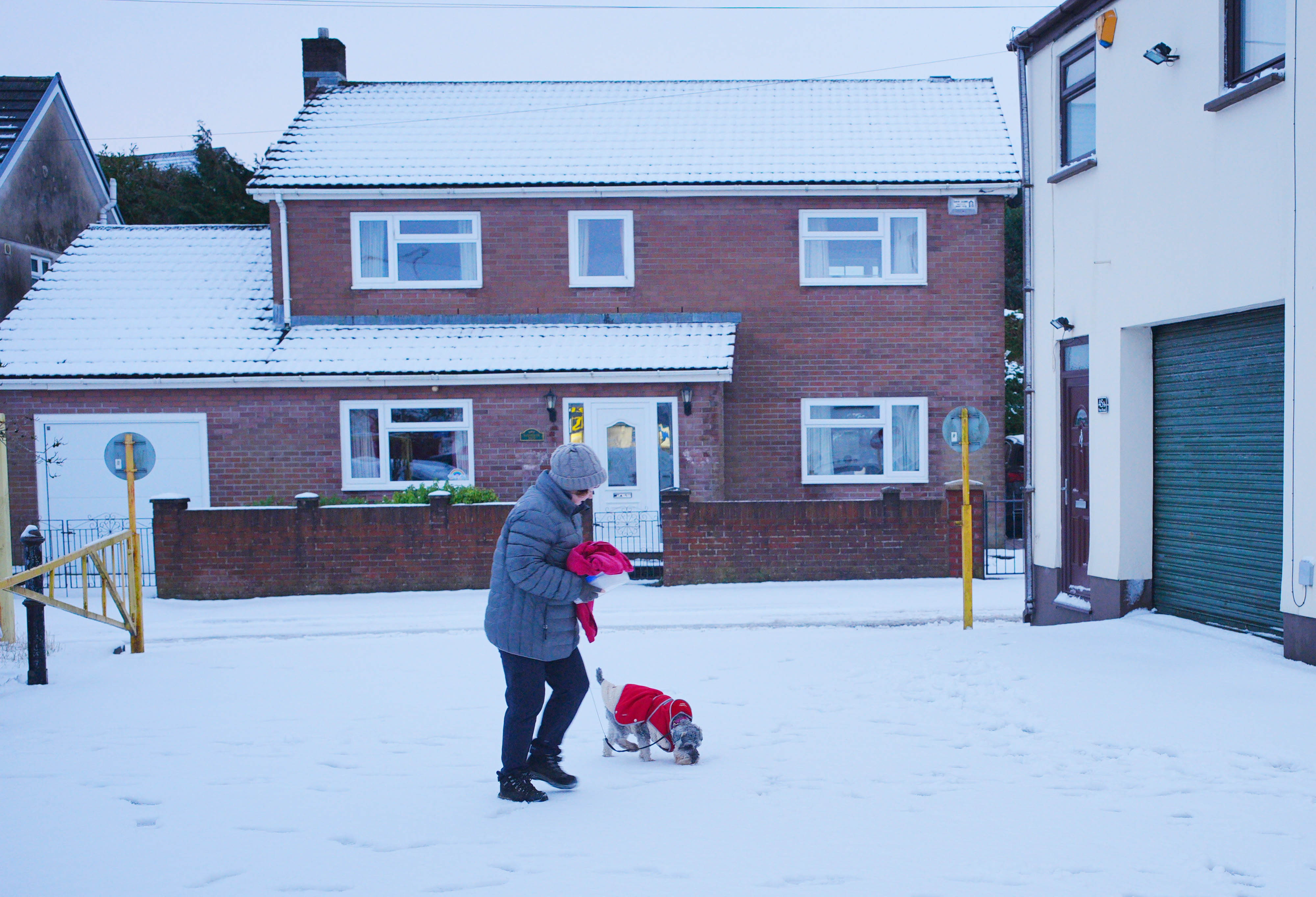 open image in galleryA woman walking through snow in Dowlais (PA)
A yellow warning for snow and ice will be in force for much of Scotland from 2am until 3pm on Sunday.
Mr Willington said: “A further 2-5cm of snow is possible to accumulate at low levels within the warning area on Sunday, with 10-20cm possible over higher ground. With much of this falling in areas that have already seen severe snowfall, ongoing disruption is likely.
“Those in central and southern England and Wales will see this fall as rain, in what will be a wet Sunday for many.”
The majority of the UK will remain covered by yellow weather warnings until Saturday.
A yellow warning for snow and ice will be in force until 3pm on Saturday, with further snowfall possible across parts of northern England and much of Scotland, while a widespread risk of ice is expected to cause disruption.
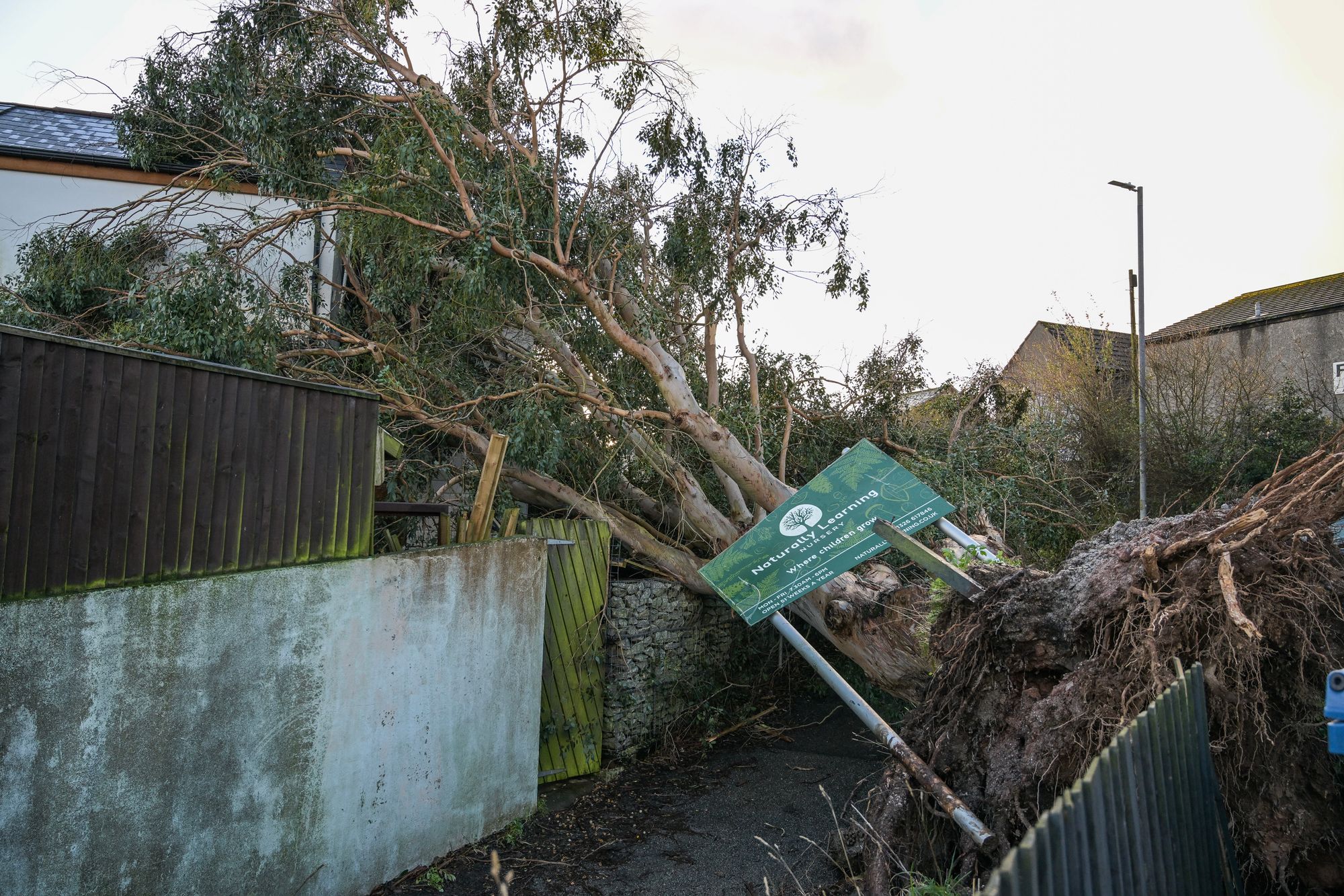 open image in galleryA fallen tree caused by Storm Goretti rests against a house in Falmouth (Getty)
A separate yellow warning for ice will cover large parts of England and Wales until midday on Saturday as thawed snow refreezes. Forecasters say this will be accompanied by wintry showers and freezing fog.
A warning for snow and ice covers the entirety of Northern Ireland until 11am on Saturday, with the Met Office warning of icy patches and some hill snow.
Then, a yellow warning covering large parts of Scotland, the East and West Midlands, North East and North West England and Yorkshire will then be in place from 2am until 3pm on Sunday.
Forecasters also warned that the combination of melting snow and rain increases the flood risk for some in the coming days.
More about
Met OfficeScotlandSnowroadsStormSouth Westschool closuresJoin our commenting forum
Join thought-provoking conversations, follow other Independent readers and see their replies
Comments